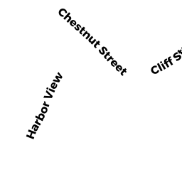
4 CHESTNUT ST
Owner Information
MORSE TONJA B
4 CHESTNUT STREET
MARBLEHEAD, MA 01945-3026


Property Details
4 CHESTNUT ST is classified as a Two-Family Residential (Multi-conv).
The primary structure on this property was built in 1910. There are 2,021ft2 of built area within this property. There is 2,021ft2 of residential/living space within this property. This property is listed as having 8 rooms. There are 2 units within this property.
4 CHESTNUT ST is valued at $484,400. The land is valued at $342,600 and the structures are valued at $141,200. There is an additional valuation of $600 on this property.
This property is in Zone B1. Confirm with local Zoning Board authorities to ensure there are no overlays or other easements on this property.
The most recent deed for 4 CHESTNUT ST is recorded at the local registrar in Book 38343, Page 24. 4 CHESTNUT ST was last sold on Tuesday, March 17, 2020 for $1.
Assessment data from fiscal year 2022.
Flood Data
According to the FEMA National Flood Hazard Layer, this property does not appear to be in a flood zone. It may also be in an area not yet reviewed. Nonetheless, confirm this information prior to taking any action.
To view the flood hazards around this property, create a FEMA "Firmette" Map of the area around 4 CHESTNUT ST.
Broadband Internet Providers
| Provider | Type | Bandwidth (mbps) | |
|---|---|---|---|
| Verizon New England Inc. | Fiber | 940 | 880 |
| Verizon New England Inc. | DSL | 15 | 1 |
| Viasat Inc | Satellite | 100 | 3 |
| VSAT Systems, LLC. | Satellite | 2 | 1 |
| HughesNet | Satellite | 25 | 3 |
| GCI Communication Corp. | Satellite | 0 | 0 |
| Comcast | Cable | 1000 | 35 |
Broadband service provider data from December 2020.
Adjacent Properties
- 3 CENTRAL ST
Single Family Residential owned by BARKER GEORGE R L/E - 14 COTTAGE ST
Single Family Residential owned by KAIN MARGARET C TRUSTEE - 59 ATLANTIC AV
Mixed Use (Primarily Commercial, some Residential) owned by MULRY EDWARD J III - 61 ATLANTIC AV
Single Family Residential owned by BARRY MICHAEL J - 63 ATLANTIC AV
Mixed Use (Primarily Commercial, some Residential) owned by DEVITO MARYANN F - 6 8 CHESTNUT ST
Single Family Residential owned by MOORE EDWARD T - TRUSTEE - 2 CHESTNUT ST
Single Family Residential owned by AMIRAULT FLORENCE A